Liste der Einträge im National Register of Historic Places im Ray County
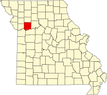
Lage des Ray County in Missouri
Die Liste der Einträge im National Register of Historic Places im Ray County in Missouri führt die Bauwerke und historischen Stätten im Ray County auf, die in das National Register of Historic Places aufgenommen wurden.[1][2]
Inhaltsverzeichnis
1 Legende
2 Aktuelle Einträge
3 Siehe auch
4 Einzelnachweise
Legende |
NRHP | Historic Place |
|---|---|
HD | Historic District |
Aktuelle Einträge |
[3] | Name[4] | Bild | Eintragsdatum | Lage | Ort | Beschreibung |
|---|---|---|---|---|---|---|
1 | Dougherty Auditorium |  | 498200001982 ID-Nr. 82003158 | 203 West Main Street 39° 16′ 42″ N, 93° 58′ 45″ W39.278333-93.979167 | Richmond | |
2 | Isiah Mansur Farmstead Historic District | 499800001998 ID-Nr. 98001063 | 17740 Highway E 39° 24′ 46″ N, 93° 53′ 11″ W39.412778-93.886389 | Richmond | ||
3 | New Hope Primitive Baptist Church |  | 498000001980 ID-Nr. 80002393 | Südwestlich von Richmond an der Old Orrick Road 39° 14′ 59″ N, 94° 2′ 37″ W39.249722-94.043611 | Richmond | |
4 | Ray County Courthouse |  | 497900001979 ID-Nr. 79001393 | 100 West Main Street 39° 16′ 44″ N, 93° 58′ 37″ W39.278889-93.976944 | Richmond | |
5 | Ray County Poor Farm |  | 497900001979 ID-Nr. 79001394 | West Royale Street 39° 16′ 22″ N, 93° 59′ 20″ W39.272778-93.988889 | Richmond | |
6 | Watkins House |  | 498300001983 ID-Nr. 83001036 | 302 South Camden Street 39° 16′ 36″ N, 93° 58′ 45″ W39.276667-93.979167 | Richmond | Entworfen von dem Architekten George Franklin Barber |
Siehe auch |
- Liste der National Historic Landmarks in Missouri
- National Register of Historic Places in Missouri
Einzelnachweise |
↑ Auszug aus dem National Register of Historic Places - Ray County Abgerufen am 17. November 2012
↑ Department of National Resources - Ray County Abgerufen am 17. November 2012
↑ Die Nummerierung in dieser Listenspalte ist an der vom National Park Service vorgelegten Reihenfolge der Einträge orientiert; die Farben unterscheiden verschiedene Schutzgebietstypen des National Park Systems mit landesweiter Bedeutung (z. B. National Historic Landmarks) von den sonstigen Einträgen im National Register of Historic Places.
↑ National Register Information System. In: National Register of Historic Places. National Park Service. Abgerufen am 9. Juli 2010.
.mw-parser-output div.NavFrame{border:1px solid #A2A9B1;clear:both;font-size:95%;margin-top:1.5em;min-height:0;padding:2px;text-align:center}.mw-parser-output div.NavPic{float:left;padding:2px}.mw-parser-output div.NavHead{background-color:#EAECF0;font-weight:bold}.mw-parser-output div.NavFrame:after{clear:both;content:"";display:block}.mw-parser-output div.NavFrame+div.NavFrame,.mw-parser-output div.NavFrame+link+div.NavFrame{margin-top:-1px}.mw-parser-output .NavToggle{float:right;font-size:x-small}
National Register of Historic Places in Missouri Adair | |


