Liste der Einträge im National Register of Historic Places im Montgomery County (Missouri)
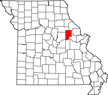
Lage des Montgomery County in Missouri
Die Liste der Einträge im National Register of Historic Places im Montgomery County in Missouri führt die Bauwerke und historischen Stätten im Montgomery County auf, die in das National Register of Historic Places aufgenommen wurden.[1][2]
Inhaltsverzeichnis
1 Legende
2 Aktuelle Einträge
3 Siehe auch
4 Einzelnachweise
Legende |
NRHP | Historic Place |
|---|---|
NHL | National Historic Landmark |
Aktuelle Einträge |
[3] | Name[4] | Bild | Eintragsdatum | Lage | Ort | Beschreibung |
|---|---|---|---|---|---|---|
1 | Sylvester Marion and Frances Anne Stephens Baker House |  | 499900001999 ID-Nr. 99001018 | 60 Boonslick Road 38° 54′ 30″ N, 91° 31′ 37″ W38.908333-91.526944 | Montgomery City | |
2 | Farmers Mercantile Co. Building |  | 500400002004 ID-Nr. 04000604 | 872 Boone's Lick Road 38° 52′ 41″ N, 91° 23′ 4″ W38.878056-91.384444 | High Hill | |
3 | Heinrich Gloe House | 500700002007 ID-Nr. 07000022 | 358 Hwy P 38° 45′ 18″ N, 91° 33′ 32″ W38.755-91.558889 | Rhineland | ||
4 | Graham Cave | 496600001966 ID-Nr. 66000420 | Rund 800 m nördlich von Mineola 38° 54′ 19″ N, 91° 34′ 23″ W38.905278-91.573056 | Mineola | ||
5 | High Hill School |  | 498000001980 ID-Nr. 80002381 | Abseits des US 40 38° 52′ 42″ N, 91° 22′ 52″ W38.878333-91.381111 | High Hill | |
6 | McKittrick Farmers Mercantile | 501000002010 ID-Nr. 10000313 | 500 Washington Street 38° 44′ 6,6″ N, 91° 26′ 33,8″ W38.735172-91.442728 | McKittrick | ||
7 | Mount Horeb Baptist Church | 498000001980 ID-Nr. 80002382 | Westlich von Mineola 38° 50′ 40″ N, 91° 38′ 31″ W38.844444-91.641944 | Mineola | ||
8 | Pinnacle Lake Rock Shelter | 496900001969 ID-Nr. 69000117 | Adresse nicht veröffentlicht | Big Spring | ||
9 | Shrine of Our Lady of Sorrows | 498200001982 ID-Nr. 82003153 | SR P 38° 44′ 2″ N, 91° 33′ 10″ W38.733889-91.552778 | Starkenburg |
Siehe auch |
- Liste der National Historic Landmarks in Missouri
- National Register of Historic Places in Missouri
Einzelnachweise |
↑ Auszug aus dem National Register of Historic Places - Montgomery County Abgerufen am 9. November 2012
↑ Department of National Resources - Montgomery County Abgerufen am 9. November 2012
↑ Die Nummerierung in dieser Listenspalte ist an der vom National Park Service vorgelegten Reihenfolge der Einträge orientiert; die Farben unterscheiden verschiedene Schutzgebietstypen des National Park Systems mit landesweiter Bedeutung (z. B. National Historic Landmarks) von den sonstigen Einträgen im National Register of Historic Places.
↑ National Register Information System. In: National Register of Historic Places. National Park Service. Abgerufen am 9. Juli 2010.
.mw-parser-output div.NavFrame{border:1px solid #A2A9B1;clear:both;font-size:95%;margin-top:1.5em;min-height:0;padding:2px;text-align:center}.mw-parser-output div.NavPic{float:left;padding:2px}.mw-parser-output div.NavHead{background-color:#EAECF0;font-weight:bold}.mw-parser-output div.NavFrame:after{clear:both;content:"";display:block}.mw-parser-output div.NavFrame+div.NavFrame,.mw-parser-output div.NavFrame+link+div.NavFrame{margin-top:-1px}.mw-parser-output .NavToggle{float:right;font-size:x-small}
National Register of Historic Places in Missouri Adair | |


